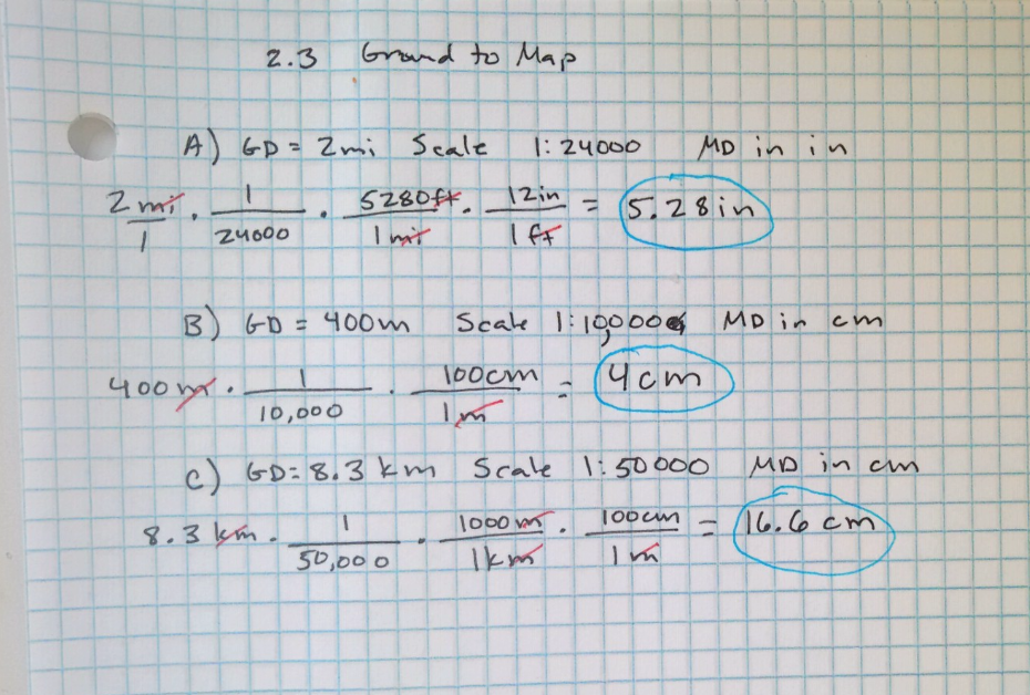
2.3 Ground Distances to Map Measurements
Applications
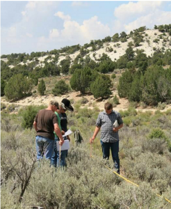
Line-intercept sampling is one way we can gather detailed information on plant communities. We may use capped rebar to mark the end of survey transects, but if we plan to repeat a survey, we’ll need to know the direction and length of each transect. A sketch map in our field notes can help! How are we going to take the measurements in the field and shrink them to make an accurate sketch on paper?
We’ll convert from distances on the ground to measurements on a map when we are plotting locations on a map or creating a map in the field. To do this, measure your distance in the field (using a tape or odometer). This will be the factor that starts your dimensional analysis. The next factor will be the scale with the ground distance in the denominator. Dividing by the ground distance makes sense because we are going from large distances on the ground to small measurements on the map. Now, set up conversion factors to take you from the measurement unit you used on the ground (usually feet, meters, miles or kilometers) to units you’ll measure on the map (usually inches or centimeters).
Examples: Ground to Map Distances
A) GD = 2 mi Scale 1:24000 MD = ? in
B) GD = 400 m Scale 1:10000 MD = ? cm
C) GD = 8.3 km Scale 1:50000 MD = ? cm
Problem Set 2.3
Your map has a scale of 1:24000. Answer the following.
- If my bus stop is 1,300 meters from school, how many centimeters away is it on the map?
- If I want to take a 3 mile walk, how many inches will I have moved on the map?
- A proposed transmission line will extend 87 kilometers from LaGrande to Baker City, Oregon. How many centimeters will it cover on the map?
- My dog can run at a speed of 5 miles per hour. If he got loose two hours ago how large of a radius should I search on my map (in cm)?
